(NOTE: The blog is called Vancouver Island in Pictures. This post is about the Flat top Islands off Silva Bay, on Gabriola Island. I choose to interpret "Vancouver Island" rather broadly. My assumption is, if the residents of a Gulf Island are served by one or more of the four post secondary institutions located on Vancouver Island, then that's good enough for me. I too will consider these islands as part of Vancouver Island.)
Before kayaking at some new location, I find it useful to determine what launching will be like. Thus, I occasionally deliberately scout out potential locations. At other times I keep a look out for possible sites. So it was as Hanne and I were driving along North Road after a nice lunch at Silva Bay Marina.
 |
Small gap in the bushes off Westgyle Road;
good enough to launch a kayak |
Out of the corner of my eye, looking down Westgyle Road, I spotted a couple of kayakers pulling two kayaks out of what seemed like bushes. This called for further investigation. It turned out that there was a small gap in the bushes, leading to a gravel beach.
Beyond a narrow strip of gravel, punctuated by the occasion log, lay a few meters of mucky, low tide sludge.
The kayakers assured me that this was a good place to launch a kayak. It looked good to me. They also extolled the merits of kayaking around the Flat Top Islands.
 |
The “launch” requires pulling the kayak down
what must be about a 45-degree incline over
mostly dried mud and some rather smooth roots
The shore itself is coarse gravel for about 5 meters,
followed by “muck” |
Perfectly calm in even the stormiest weather, they said. I promised myself to come back to give it a try.
In July of 2010 Britta and I set out for Gabriola Island. After catching the ferry from Nanaimo and a little breakfast in downtown Gabriola, we arrive at our launch site at Silva Bay. It was a “lowish” tide. More on that later.
We launched without incident and started our leisurely paddle away from the shore. Before leaving home, I'd taken out the charts we needed. And promptly left them in the living room. We were now “navigating” by the Chamber of Commerce map we picked up at the ferry terminal. Generally, that's not good practice.
Check out the last picture in this post to see why checking tide tables and checking potential launching sites at all possible tides is a good idea.
Enjoy our story in pictures:
 |
While I schlepped the kayak to the water's edge,
Britta waited at the bottom of the 7 meter slope
with the kayaking paraphernalia
|
AD
AD
 |
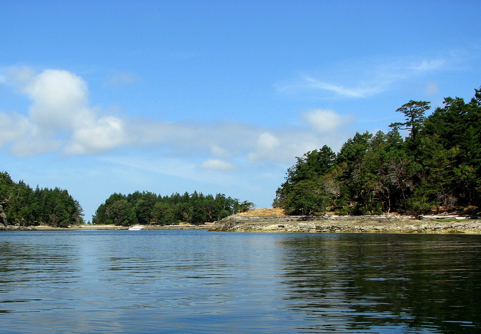
Having rounded Law Point,
we hug the Gabriola Island shore.
We can't tell if this route will take us into a bay,
or if there's a gap ahead |
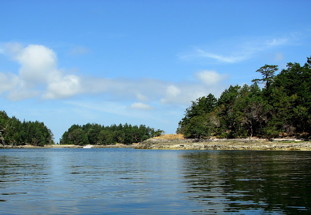 |
Is this a bay, or can we get out?
Turns out, there's a gap ahead (Lily Island to the right) |
 |
Along the Gabriola shore, the characteristic sandstone;
this time with cannonball-sized holes.
Perhaps where concretions dropped out over time |
 on Carlos Island") |
| A yellow kayak (not ours) on Carlos Island |
 beneath the water off Carlos Island") |
| Beautiful milky-coloured ground (plenty of broken clam and oyster shells) beneath the water off Carlos Island |
 |
| Little bay on eastern shoreline of Vance Island beckons to be explored |
 into the Strait of Georgia * **") |
| Looking past Gaviola Island (Rowboat Point) into the Strait of Georgia |
 |
Britta noted a distinct fishy odour about.
Seal poop? Seal breath? Who knows?
|
") |
Upon leaving our seal friends, we paddled over to Bath and
|
 |
Seals watch us drift by; an Oyster Catcher
takes care of business in the background
|
 |
| Cute cabin on the shores of Sear Island |
 |
| A narrow gap will lead us into the Silva Bay anchorage |
 |
As we pull the kayak through the muck, Britta feels a tiny crab in her shoe.
She screams. The next time we look, this deer is gone! |
 |
This picture gives only a partial indication of what distance we
had to pull the kayak. There was no thought, ever,
of carrying it, as we would have sunk too deeply into the mud! |
")


 on Carlos Island")
 beneath the water off Carlos Island")

 into the Strait of Georgia * **")


")


 so as not to miss the sailing of the MV Frances Barkley")
")
 the MV Frances Barkley (2009-07-06)")
")
")
")
")
")
")
")


")


")


