Showing posts with label Long Beach. Show all posts

Thursday, July 13, 2017

Long Beach - Chesterman Beach

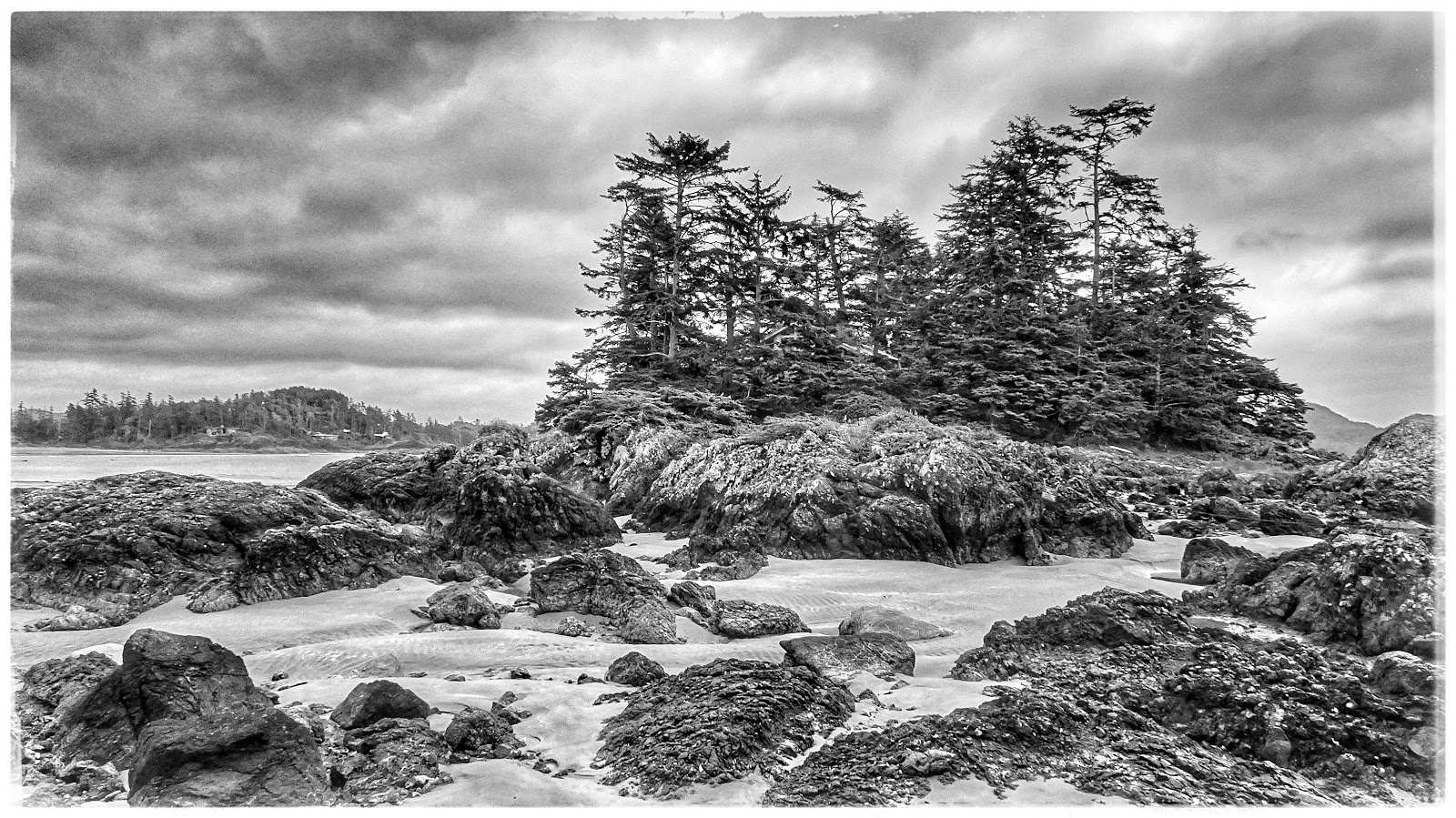
Sabrina's recent visit seemed like as good an excuse as any to spend a few days in Pacific Rim National Park. As part of this outing, we spent a few hours wandering about on Chesterman Beach (2017-06-28).

Frank Island off Chesterman Beach. Sometimes black and white photographs also look good, I reckon.

At low tide, Chesterman Beach presents a vast, sandy beach...
Human ingenuity uses available materials (drift logs) to create a useful bench...

The rock-water interface often teems with sea life...

Saltwater pools with sea life - in this case, sea anemone...


Monday, April 6, 2015

Long Beach - A trip in February

It's February. Not a good time of year to travel to the west coast of Vancouver Island, you'd think. WRONG! In our mind, ANYTIME is a good time for a visit to Ucluelet, Tofino and Long Beach.

Follow the rest of our trip report on the captions to the pictures...
  • 2014-02-01 
  • 48.923, -125.537
Compulsory stop at the water rushing past islands of rocks near Wally Creek.  Parking and access has been made easy.  However, DON'T attempt to walk about the rocks if they're wet!
Compulsory stop at the water rushing past islands of rocks near Wally Creek.
Parking and access has been made easy.
However, DON'T attempt to walk about the rocks if they're wet!


Once we arrived in Ucluelet, we had enough time for a short walk  along the Wild Pacific Trail to the lighthouse at Amphitrite Point.
Once we arrived in Ucluelet, we had enough time for a short walk
along the Wild Pacific Trail to the lighthouse at Amphitrite Point.

A good view of what is known as the "Graveyard of the Pacific"
Amphitrite Lighthouse on the Wild Pacific Trail


Sunday, August 11, 2013

Scenes at the Tofino Dock on a Rainy May Day

A rainy day in May at Tofino (2013-05-27)

Enjoy this trip report in pictures!

Wet, rainy dock in Tofino (or any place Wet Coast BC)


Across the water, Opitsaht... a community of the Tla-o-qui-aht people of the Nuu-chah-nulth nation, located at the SW end of Meares Island
Across the water, Opitsaht...
a community of the Tla-o-qui-aht people of the Nuu-chah-nulth nation,
located at the SW end of Meares Island


Does it get any more WEsT Coast than this?


A touch of colour on an otherwise grey day in Tofino


Quintessential West Coast


Mountains, shrouded in mist


Thanks for the visit!


Wednesday, August 7, 2013

Incinerator Beach at Long Beach (Tofino)

Incinerator Beach is located at the northern end of Pacific Rim National Park and is thus the park beach  closest to the village of Tofino.

Incinerator Beach with Lovekin Rock in the distance
Incinerator Beach with Lovekin Rock in the distance (2013-07-12)
Located 32 kilometres from the Highway 4 T-intersection (the Tofino-Ucluelet junction) but only 16 kilometres from Tofino, Incinerator Beach seems busier than other beaches in the park. This may be due to it's proximity to the village, or the fact that it appears to be favoured by surfers and those who like to watch their pursuits. In fact, we first visited Incinerator Beach after we had inquired in Tofino about where we might observe the most surfing activity.

Incinerator Beach; favoured by surfers
Incinerator Beach; favoured by surfers (2013-07-12)
Incinerator Rock is a section of beach - the northern end of Long Beach - rather than a beach on its own. It makes up the northern end of Long Beach, and is a favorite of local surfers. Incinerator Beach provides plenty of opportunity to view surfers and also, if you hunt around, you might also find the occasional nooks and crannies ideal for reading or tanning. For photographers, an extra bonus  is the high rock that juts out into the water. A short hike up this rock rewards the photographer with great views of surf, sand, and surfers. 

Climb the rock for a better view of Incinerator Beach
Climb the rock for a better view of Incinerator Beach; 
Lovekin Rock in the distance (2013-07-12)
In earlier days, long before a paved highway was the primary means of transport, a footpath near Incinerator Beach connected a sheltered bay on the other side of Esowista Peninsula - the geographical feature defining this area around Tofino - to the wilder, surf-pounded Pacific shore.
Climb the rock for a better view  of the north end of Incinerator Beach
Climb the rock for a better view
 of the north end of Incinerator Beach (2013-07-12)
Thus, canoes were landed on the quiet mudflats in Grice Bay and a trail lead to the ocean. 


Incinerator Beach; a portion of Long Beach
Incinerator Beach; a portion of Long Beach (2013-07-12)


Thursday, August 1, 2013

Vancouver Island in Pictures, Post #01

Let's start this blog off with a few recent pictures of Vancouver Island.

You can't go too far wrong by starting off with images from the Long Beach area; in this case, three pictures from Florencia Bay.
The quintessential West Coast beach scene; drift logs and fine sand

Beautiful sandy beaches, so typical of Long Beach

Strolling along the beach, I'm accompanied by the persistent "peeeep", peeeeep" of a pair of Oyster Catchers
*  ===